WEBSITES AND ADDITIONAL RESOURCES
The Kalorama area within the Northwest quadrant of Washington, D.C., includes the residential neighborhoods of Kalorama Triangle and Sheridan-Kalorama. The area is accessible from the Dupont Circle and Woodley Park Metro stations, as well as various bus lines. Kalorama Triangle is bordered by Connecticut Avenue, Columbia Road, Calvert Street, and Rock Creek Park. Sheridan-Kalorama is immediately southwest, located between Connecticut Avenue, Rock Creek Park, Massachusetts Avenue, and Florida Avenue.
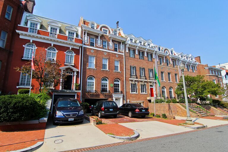
The Kalorama Triangle is a residential enclave of Adams Morgan, located in Northwest Washington bounded by three major thoroughfares: Connecticut Avenue, Calvert Street, NW and Columbia Road.
The neighborhood is served by mass transit, with the Woodley Park Metro station across the Taft or Duke Ellington Bridge, Metrobus lines and one of the DC Circulator lines stopping along its northern border.
Sheridan-Kalorama, also known as Kalorama Heights, is bounded to the north and west by Rock Creek Park; to the south and west by Massachusetts Avenue N.W.; and to the south and east by Florida Avenue and Connecticut Avenue N.W.
The Kalorama area was primarily rural until the close of the 19th century, lying northwest of the original limits of Washington City from L’Enfant’s original plan. In 1795, Gustavus Scott, a commissioner for the District of Columbia purchased the property, which had been a portion of Anthony Holmead’s “Widows Mite” holdings. He constructed a large, classically styled house at 23rd and S Streets, which he named “Rock Hill”. In 1803 Margaret Scott the wife of Gustavus Scott sold the property to William Augustine Washington. In 1807, the noted poet Joel Barlow bought the property and renamed it “Kalorama,” which translates from Greek as “fine view.” Barlow lived in the home until shortly before his death in 1812. Barlow commissioned Capitol architect Benjamin Latrobe to enlarge the house and elevate its design. Kalorama (the residence) was destroyed by a fire during the American Civil War while it was used as a Union hospital. The residence was rebuilt and returned to a single-family home until 1887, when it was leveled by the District of Columbia government for the extension of S Street NW.
In the early 1880s, the Kalorama area, being located beyond Boundary Street (now Florida Avenue) and thus outside the city limits, which had hithero remained primarily undeveloped, began to be subdivided for urban development. In 1893 Congress ordered L’Enfant’s design of the city of Washington extended outward to include the rest of the District. Existing developments were exempted, which is why Kalorama is one of the few portions of D.C. that does not comply with the city’s grid system for streets. Two high bridges over the deep gorge of Rock Creek became important to the development of both sides of Kalorama in this period, the Calvert Street bridge (since replaced by the Duke Ellington Bridge), built in 1891, and the Taft Bridge (on Connecticut Avenue), built in 1907.
The Sheridan-Kalorama Historic District is located in southwestern Kalorama.
Information provided from Wikipedia.

